Much-needed rainfall is expected to round out the weekend in Charleston as a front moves closer to the Lowcountry. While the rain will continue through the day, conditions should gradually dry out by evening. Despite the wet weather, rainfall totals will remain under 1/2 inch, which will not have a significant impact on drought conditions.
Weather Today: Scattered Showers and Cooler Temperatures
Throughout the day, scattered showers are possible, with the chance of a few storms this afternoon. Fortunately, severe weather is not expected. Temperatures will be a bit cooler, with highs in the upper 70s to low 80s. As the evening approaches, expect temperatures to drop to the mid 50s to nearly 60 degrees.
Looking Ahead: Breezy Monday and Dry Conditions
As we head into the new week, Monday will start off dry with a mix of clouds and sunshine. Winds will pick up, with gusts ranging between 20 to 25 mph. With limited rainfall in certain areas, fire danger may rise, especially in regions that remain dry. As a precaution, residents are urged not to create sparks.
Due to the ongoing drought, the South Carolina Forestry Commission has issued a statewide Burn Ban, which prohibits most outdoor burning activities. This includes yard debris burning, prescribed burns, campfires, bonfires, and other recreational fires in unincorporated areas of the state. However, grilling and safe fire pit use are allowed.
Forecast Summary
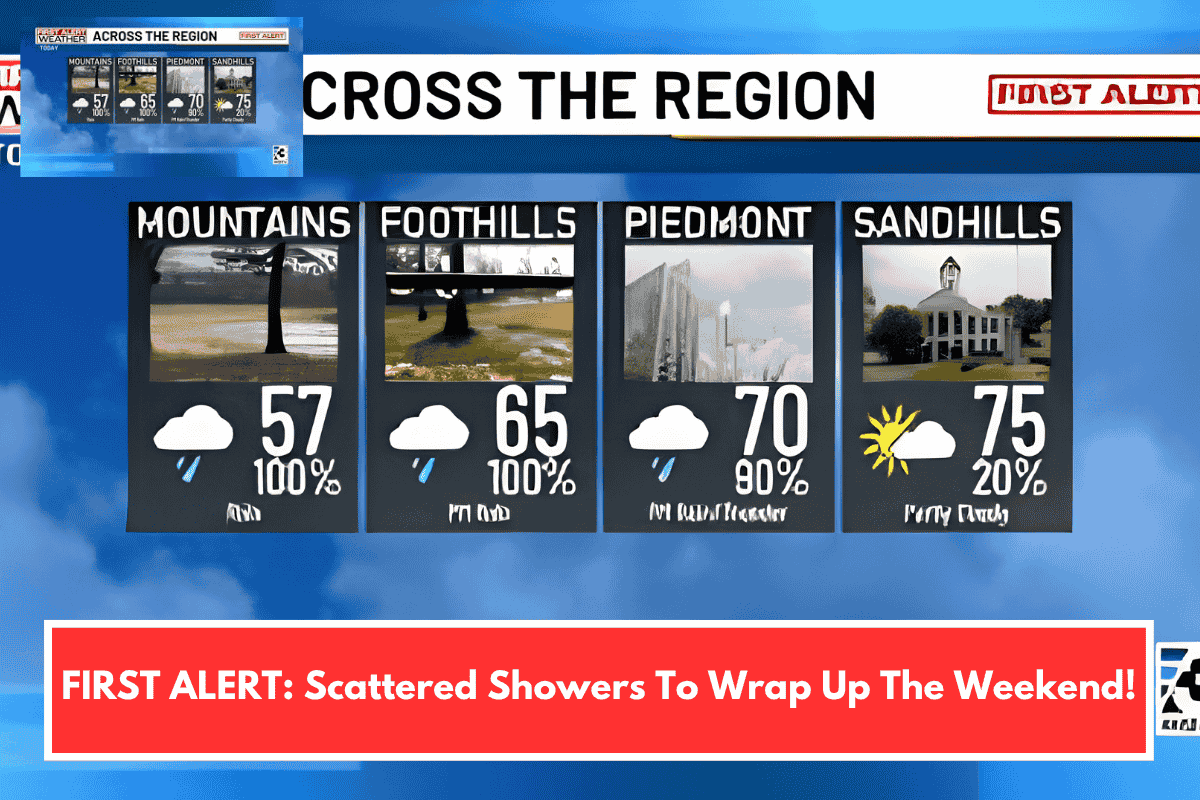
- Sunday: Sun & Clouds with scattered showers and storms. High: 80°F. Low: 54°F.
- Monday: Partly cloudy with breezy conditions. High: 74°F. Low: 56°F.
- Tuesday: Mostly sunny. High: 78°F. Low: 64°F.
Stay safe and prepared as the weather shifts over the weekend and into the start of the week!