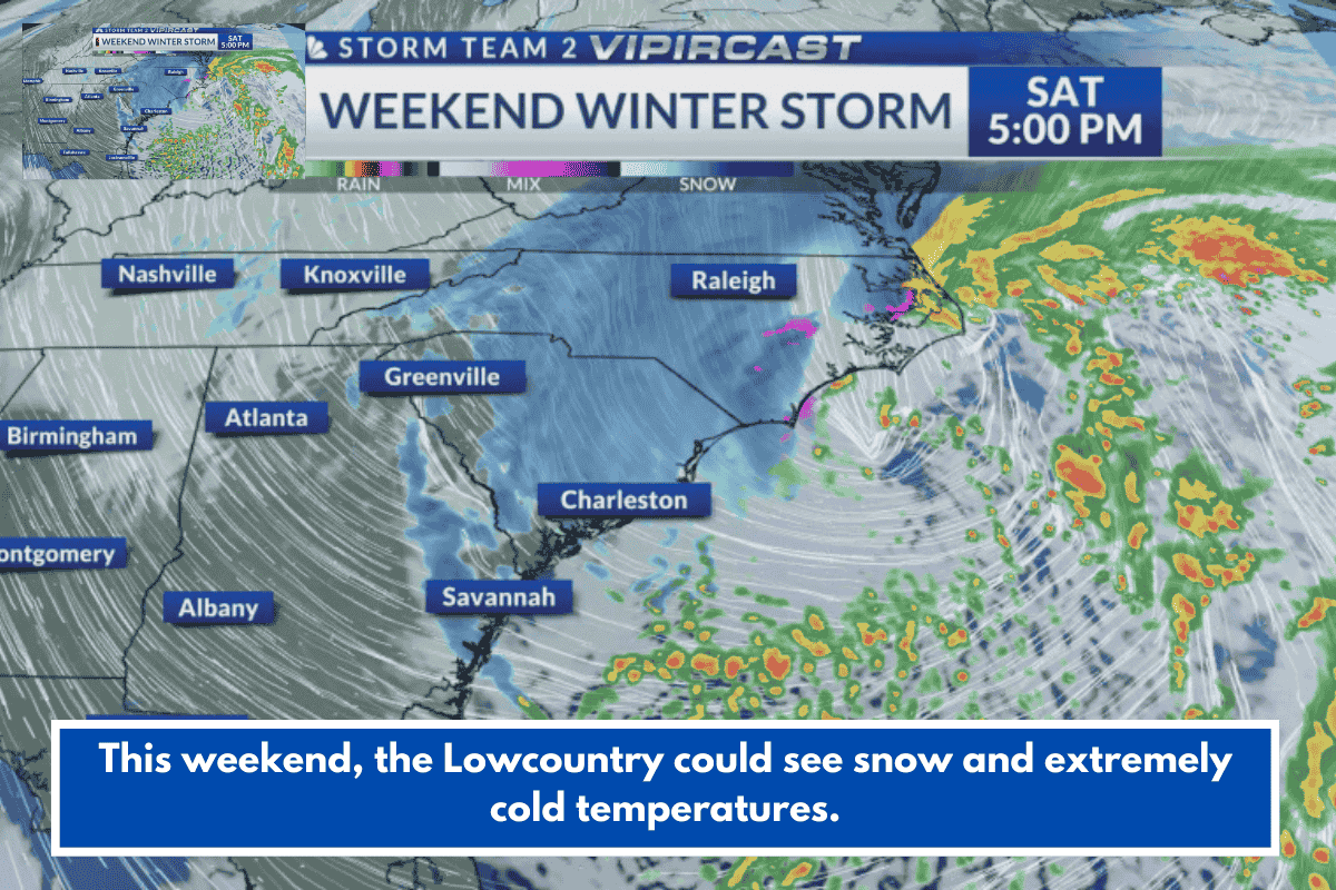
A winter storm watch is in effect for much of South Carolina, including Georgetown and Williamsburg Counties, from late Friday night through Sunday afternoon, with accumulating snow and arctic air forecast for the Lowcountry coast on Saturday and Sunday.
Forecast Details
An offshore low-pressure system will bring initial rain transitioning to sleet midday Saturday, then snow by evening, with light accumulations expected across the region. Heavier snow may impact eastern North Carolina and possibly Horry County, while the Lowcountry faces tricky travel late Saturday through Sunday due to snow on all surfaces.
Weather Impacts
Extremely cold air will drive wind chills into the single digits overnight Saturday into Sunday morning, with very cold conditions persisting into Monday. Lingering snow could cause traffic issues through Sunday evening or even Monday morning, so prepare for disruptions.