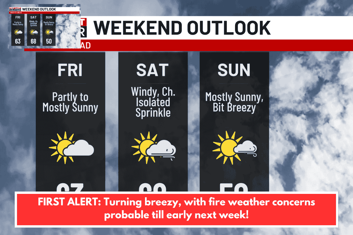
Charleston, South Carolina – We are tracking an approaching dry cold front, which will provide us with a warm – but breezy – finale to the weekend!
As the front moves towards the Carolinas overnight, we’ll get a few high clouds. After midnight, southwesterly breezes are expected to gradually strengthen, maintaining temperatures in the 50s or low 60s until early Sunday morning.
A Lake Wind Advisory is in force for Berkeley, Orangeburg, and Clarendon counties until 3 p.m. Sunday. Ahead of the cold front, the aforementioned counties may experience gusts of up to 35 MPH, primarily close and downwind of Lake Moultrie and Marion. Elsewhere, expect gusts of 25-30 MPH through Sunday afternoon.
Fire weather hazards will persist through Sunday and Monday owing to a mix of higher winds (more prevalent on Sunday) and low relative humidity levels. Use extreme caution outside, as any fire that starts can spread quickly.
High pressure will return to the Southeast on Monday, indicating dry and pleasant weather ahead. Monday should be the coolest day of the next work week, with afternoon highs in the mid to upper 60s and overnight lows in the 30s and 40s.
Temperatures are expected to increase to seasonably high levels by midweek (low to mid 70s), before levelling off in the upper 70s on Friday and Saturday. Most forecast models continue to predict dry weather through late week; trends will be studied for next weekend, when a stronger cold front may pass over the Lowcountry.