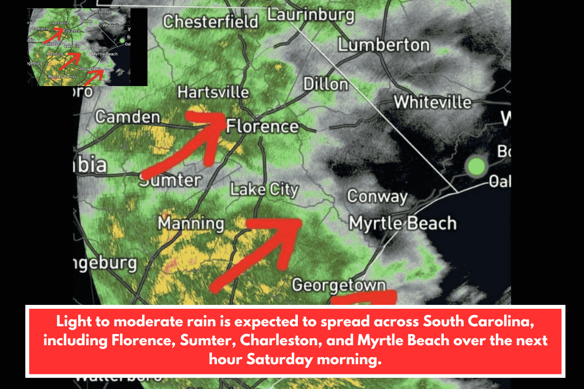
As of 9:15 AM on Saturday, May 2, 2026, a large area of light to moderate rain is spreading across South Carolina, with coverage expected to expand significantly over the next hour. The heaviest rain cores are concentrated across the Florence, Sumter, Manning, Moncks Corner, and Georgetown areas, pushing northeast toward the coast. This widespread rainfall is already affecting Charleston and the surrounding Lowcountry, with more regions across the Midlands and Grand Strand set to experience increasing rainfall through the late morning hours.
Heavy Rain Moving Northeast Across Key Areas
The most intense radar returns at 9:15 AM are located across the Sumter, Manning, and Florence corridors, where heavy rainfall is expected to persist. The storm is moving northeast, with the heaviest activity advancing toward Florence, Lake City, and the broader Pee Dee region. Communities such as Camden, Hartsville, and Orangeburg are currently experiencing heavy rainfall, which may lead to reduced visibility and ponding on roadways.
Lowcountry and Coastal Areas Seeing Active Rainfall
To the south, Georgetown, Moncks Corner, and Charleston are already under active rainfall, with the rain shield continuing to push toward the coast. Over the next hour, areas like Conway and Myrtle Beach are expected to be pulled into the growing rain zone as the system moves further northeast.
Communities such as Lumberton, Laurinburg, Whiteville, and Dillon are also positioned in the path of the advancing rain and can expect increased coverage over the next hour.
Rain Expected to Expand Throughout the Morning
The overall rain area is forecast to expand significantly through the 10 AM to 11 AM window, bringing light to moderate rain to regions that are currently on the dry edge of the system. Residents in the Midlands and coastal zones should expect wet conditions to persist throughout the late morning hours on Saturday.
Stay tuned to local news sources for the latest weather updates as the storm system continues to impact South Carolina.