High pressure keeps conditions seasonably cold through New Year’s, with clear skies and light winds driving overnight chills. Expect a widespread freeze early Wednesday morning, dipping into the 20s inland.
Key Forecasts:
- Tonight (New Year’s Eve): Clear and colder than Monday; upper 30s to low 40s by midnight. Dress in layers for outdoor festivities.
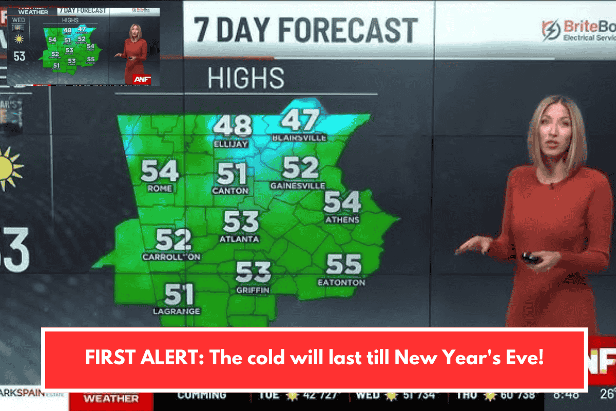
- Wednesday (NYE Day): Sunny with highs in the low to mid 50s.
- Thursday-Friday: Warming trend to around 60° afternoons as a western storm approaches.
- Saturday: Similar 60° highs, but isolated showers start pre-dawn, turning to light-to-moderate rain through evening (under 1 inch total).
- Sunday: Drier air returns.
This setup aligns with typical Lowcountry winter patterns—chilly starts warming mid-week before mild Atlantic influences. Safe celebrations, and bundle up tonight!
Planning any New Year’s events or hikes in the area?