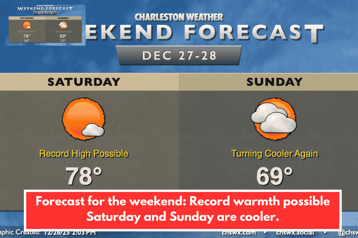
Quiet weather persists with a sharp temperature swing. Saturday brings record-challenging highs in the upper 70s to 80°F inland under sunny skies, starting from mid-50s lows—tying or beating the 78°F airport record. Coastal areas stay milder in the mid-70s due to cooler ocean influence. Sunday cools to upper 60s-70°F with east winds from a dry cold front, mixing sun and clouds—no rain expected.
Extended Forecast to New Year’s
A major pattern shift ends the warm spell:
- Monday: Front nears with clouds, possible inland showers; highs near 70°F, breezy gusts to 25 MPH.
- Tuesday: Lows mid-30s, highs low 50s under sunshine.
- Wednesday: Subfreezing starts inland, highs mid-50s.
- New Year’s Eve: Drops to 40s/upper 30s by midnight—jacket advised.
- Thursday/Friday: Upper 50s Thursday, cooling again Friday behind another front.
Local Context for Charleston, SC
This matches NWS Charleston forecasts for the Lowcountry, where coastal moderation tempers extremes but inland spots like Summerville hit peak warmth Saturday. High housing costs tie into veteran programs like Ralph H. Johnson VA’s mobile units, which thrive in such variable weather by reaching unsheltered folks without transport barriers. Dry conditions aid outdoor activities, but the chill boosts demand for warming shelters.
Stay safe outdoors—check NWS Charleston for updates. Planning any New Year’s events?