This forecast covers the Coastal Empire and Lowcountry areas around Savannah, GA, with a mix of warming, rain, and cold snaps ahead. High pressure brings a brief warmup midweek, but a cold front ushers in rain risks this weekend, including potential freezing rain farther north. Colder air dominates early next week.
Daily Breakdown
- Thursday: Highs near 69°F, lows 43°F. Clouds give way to sun.
- Friday: Highs around 70°F, lows 47°F. Mix of sun and clouds.
- Saturday: Front arrives; highs in the 50s from 40s starts. 40% rain chance after sunset.
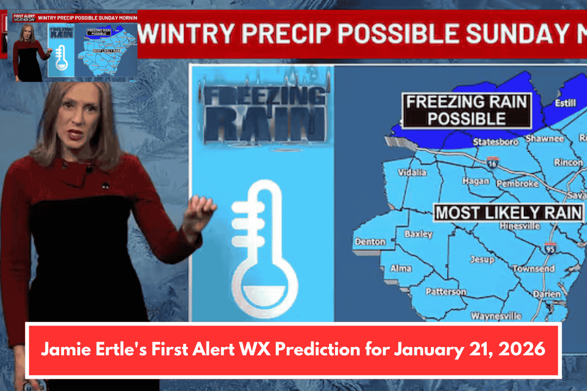
- Sunday (First Alert Weather Day): Highs 59°F, lows 39°F. 80% rain chance; freezing rain possible mornings in Hampton, Screven, Bulloch, Candler, and Toombs counties before turning to rain.
- Monday: Highs 47°F, lows 37°F. Cloudy morning, sunny afternoon.
- Tuesday: Highs 41°F, lows 24°F. Mostly sunny.
- Wednesday: Highs 52°F, lows 25°F. Mostly sunny.
Alerts and Marine Conditions
- Freezing rain threat is shifting north but still possible Sunday morning in northern counties—monitor updates as models evolve.
- Marine: Hazardous conditions this weekend with strong northeast winds late Friday through Saturday night, gusts to 30 knots. Small Craft Advisory likely.
Stay safe outdoors, especially on water or in northern areas. Prep for slick roads Sunday if you’re in those counties. Any specific plans this weekend I can help check against the forecast?