- Cool-down phase (now through Friday): Cloudy skies with possible spotty showers mid-week, lows in the mid-30s Wednesday night. Thursday brings partly sunny skies and highs around 48°F, followed by a sharp drop to 20-25°F overnight—well below freezing.
- Friday: Sunny and pleasant, highs near 50°F, but still chilly.
- Saturday: Quick warm-up to mostly sunny 62°F highs.
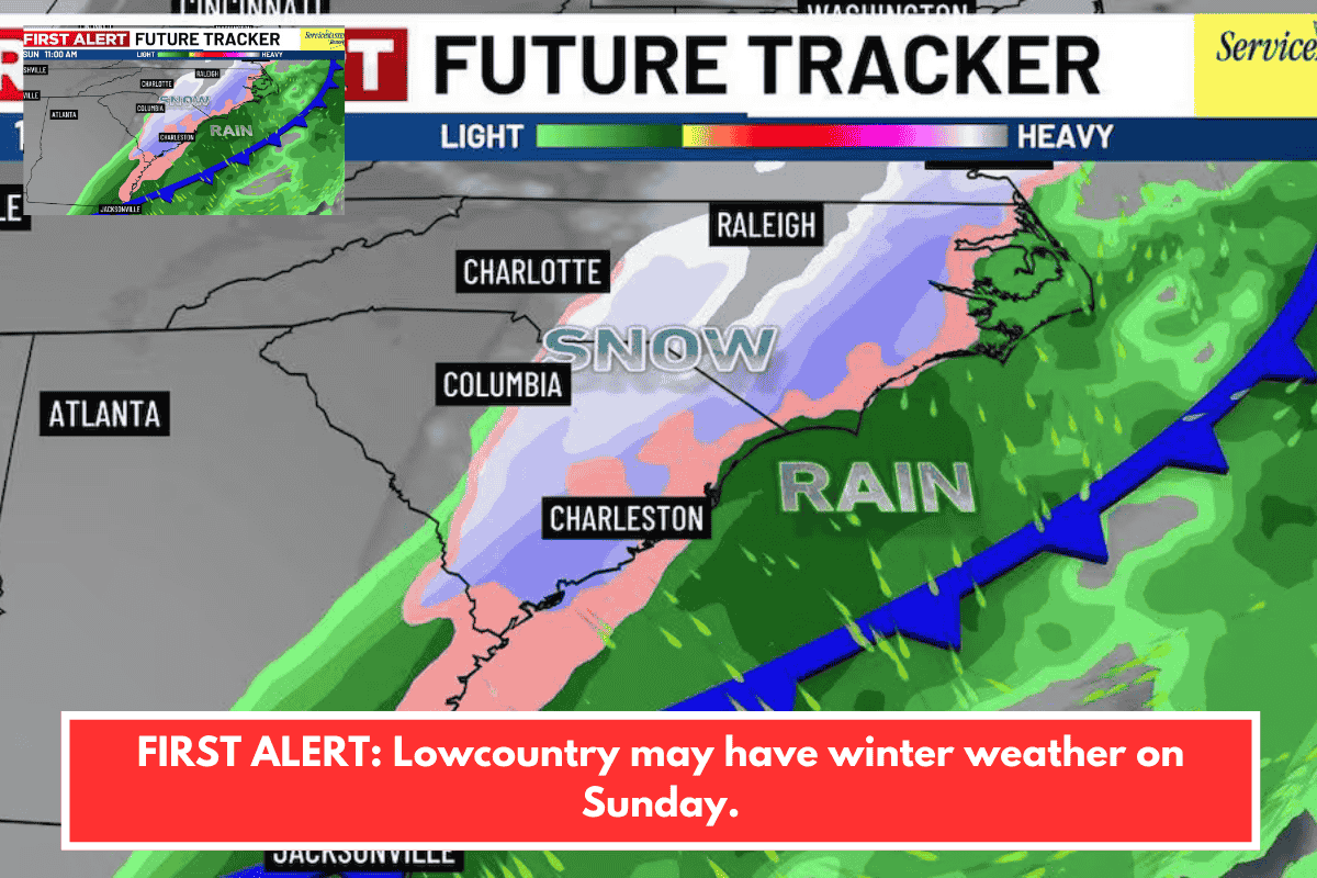
- Sunday morning: 30% chance of rain/snow showers or wintry mix, especially if moisture levels cooperate. Coastal areas unlikely to see much accumulation; inland spots have better odds. Models (GFS, EURO) suggest potential, but timing and moisture remain uncertain.
Why This Matters for Charleston Area
This setup echoes rare Lowcountry winter events, where cold air masses clash with Gulf moisture. Thursday night’s freeze could impact pipes, plants, or outdoor pets—protect them with covers or insulation. Sunday’s possible flurries might slick roads briefly, even without heavy snow, given the chill.
Preparation Tips
- Monitor updates from Live 5 Weather or National Weather Service Charleston.
- For Sunday plans (hikes, events, or drives): Have wipers, de-icer, and layers ready; delay outdoor starts if showers hit.
- Indoor alternative: Check local spots like Charleston Music Hall for concerts or community centers for warmth.
Stay tuned—forecasts can shift. Planning anything specific this weekend?