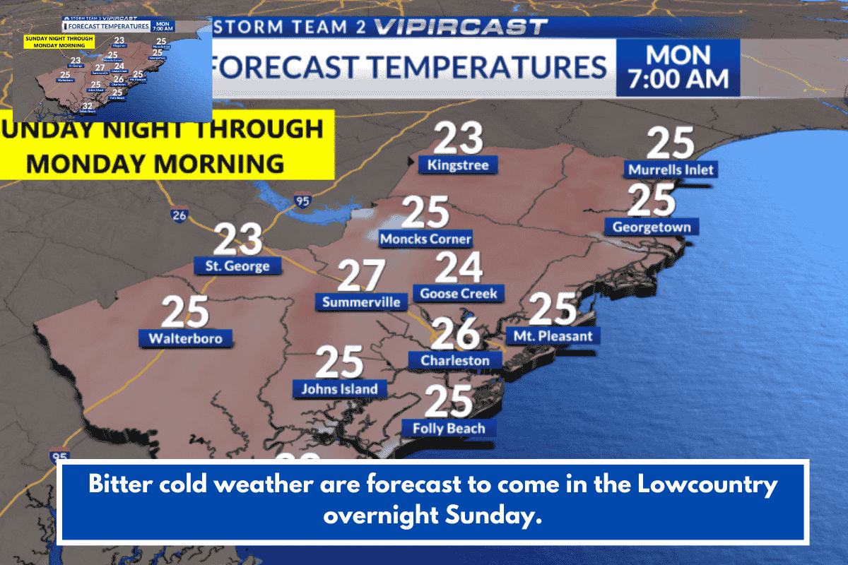
A strong arctic cold front is bringing gusty winds and frigid temperatures to the Lowcountry this weekend. Overnight lows into Sunday evening are dropping into the low 20s, with wind chills reaching the teens by early Monday amid breezy conditions.
Forecast Details
Monday highs will only reach the low 40s, about 20 degrees below average, followed by another cold night with lows in the 20s. Inland areas may see upper teens, while coastal spots stay slightly warmer in the mid-20s to low 30s. Conditions improve by Wednesday, with highs returning to the mid-60s.
Weather Alerts
An Extreme Cold Watch covers Berkeley, Charleston, inland Colleton, and Dorchester counties from 10 p.m. Sunday to 10 a.m. Monday. A Cold Weather Advisory applies to Beaufort and coastal Colleton during the same period, with possible Gale Watch for coastal waters due to northwest gusts up to 35 knots.
Safety Tips
Protect people, pets, and plants from the hard freeze; drip faucets to prevent pipe bursts and use space heaters cautiously. Layer clothing, including gloves, hats, and scarves, as wind chills could hit single digits inland.
THINGS 2 REMEMBER DURING FREEZING TEMPERATURES
Cover sensitive plans; the frost and freeze could harm or kill crops and other sensitive vegetation. People should take steps to protect tender plants from the cold.
Bring your pets inside, especially overnight.
If you are outside, dress in layers and try to stay warm.
Protect exposed pipes from freezing; wrap them or allow them to slowly drip.