Hilton Head residents will need to swap their flip-flops for coats next week, as colder weather reach the seaside area on Tuesday.
A strong cold front will move across the Lowcountry on Sunday, bringing the coldest weather of the season thus far, with freezing temperatures anticipated early next week.
Before the cold arrives, the weekend will be warm. The outlook for Saturday is mostly sunny with highs in the upper 70s and low 80s, followed by a partly cloudy Saturday night with lows in the mid-60s.
Sunday may bring a minor risk of showers or thunderstorms in the afternoon before the front passes through.
According to the National Weather Service Charleston Office, a cold front will move over the region late Sunday afternoon, clearing any remaining showers by Monday morning. The skies will clear, but temperatures will drop behind the front.
Sunday night temperatures are forecast to drop into the mid 40s inland and the high 40s by the coast.
When to Expect a Chill
Monday will be dry and cool, with wind gusts in the 20s, and daytime highs in the low to mid-50s, much below usual for early November.
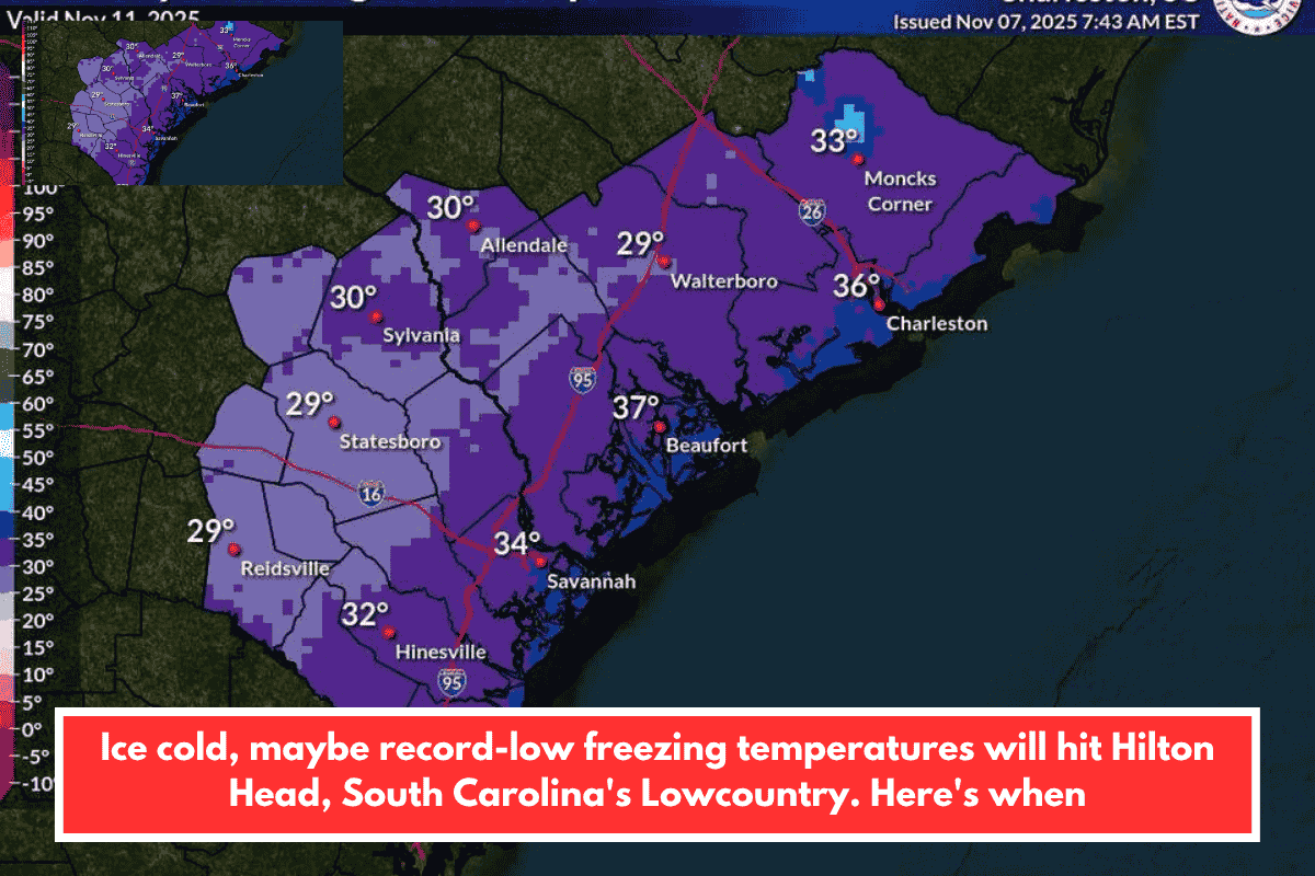
The real cold, however, will approach Monday night and Tuesday morning, when coastal counties are expected to see record low temperatures of about freezing. Hilton Head is predicted to have temperatures around 38 degrees Monday night.
According to the NWS, these temperatures are among the coldest of the season, and a freeze watch or warning will most certainly be issued for much of the region.
Coastal locations have a 10-20% risk of freezing, which rises to 90-95% further inland.
midweek warm-up
Later on Tuesday, temperatures will warm considerably, with highs in the 50s and overnight lows near freezing inland and in the upper 30s to low 40s near the coasts.
By midweek, temperatures are forecast to recover to more normal November levels. Highs likely return to the 60s by Wednesday and Thursday.
No tropical development is forecast in the Atlantic over the following seven days, as the hurricane season officially finishes on November 30.
For the most recent forecast updates, go to the NWS Charleston 7-day forecast webpage.