Columbia, South Carolina — A cold front moved in yesterday and will briefly cool us off this afternoon.
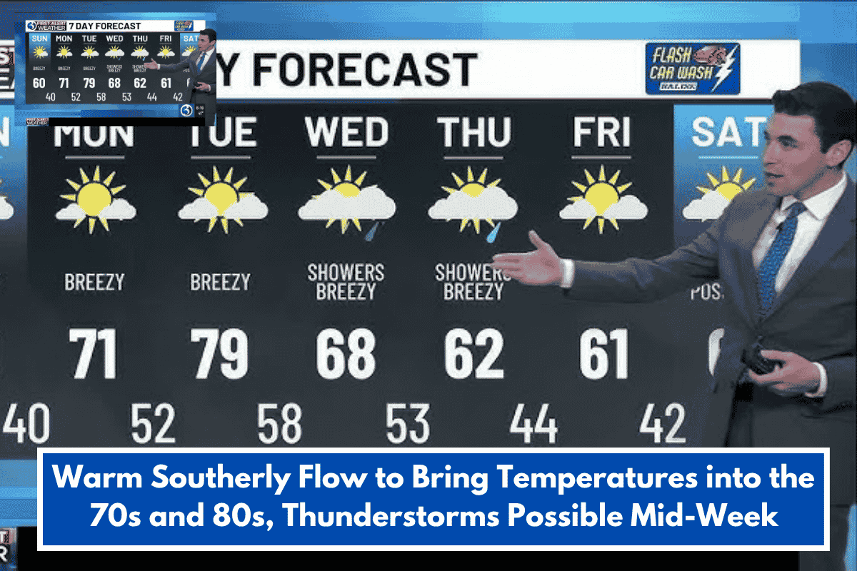
This afternoon’s highs should be in the upper 60s, which is near average.
This seasonable air will not last long; temperatures will return to the 70s and 80s for the rest of the week.
Meanwhile, low temperatures will remain in the 40s or 50s every night for the next week.
Dry weather is likely to remain for the next few days, but humidity will creep in, making the Midlands seem more like spring.
Our next weather system should bring showers to the area on Friday and Saturday.
This system may bring some severe weather to our west, so keep a look out for thunderstorms as well.
However, the severe threat is anticipated to subside before the front arrives in the Midlands.
If we fast forward to Thanksgiving week, the weather does not look much different.
According to long-range projections, temperatures in the southeast United States will likely continue above average.
Colder weather is expected to arrive sometime in early December.
Occasional rain is expected Thanksgiving week as well, but showers and storms will be more common in the central United States.