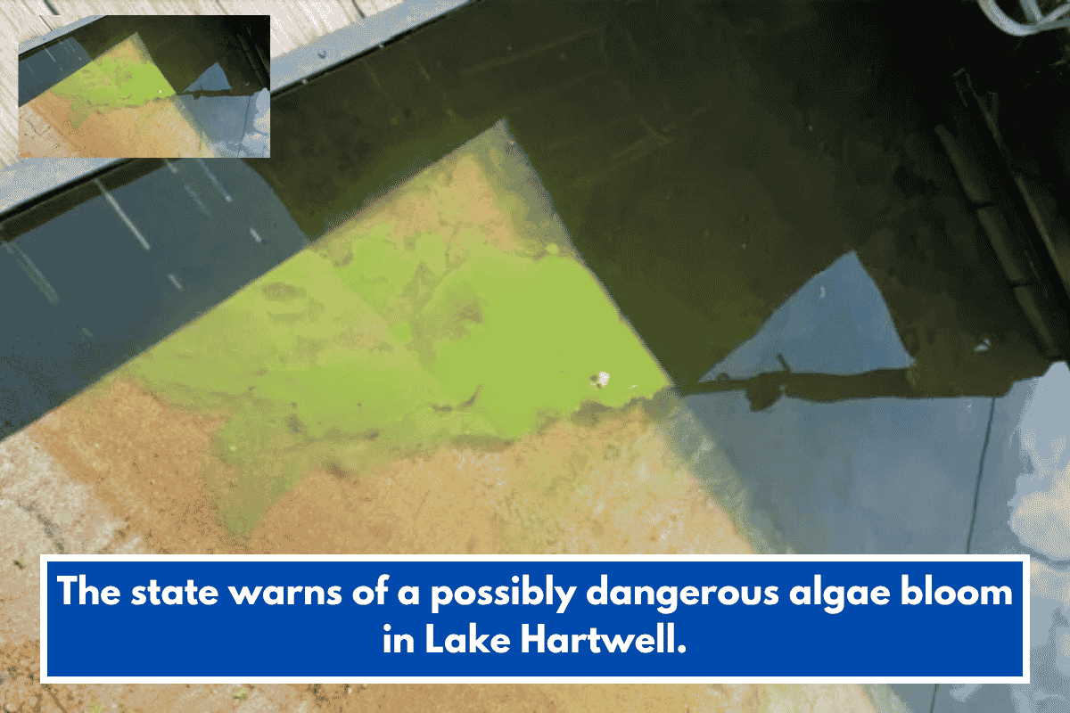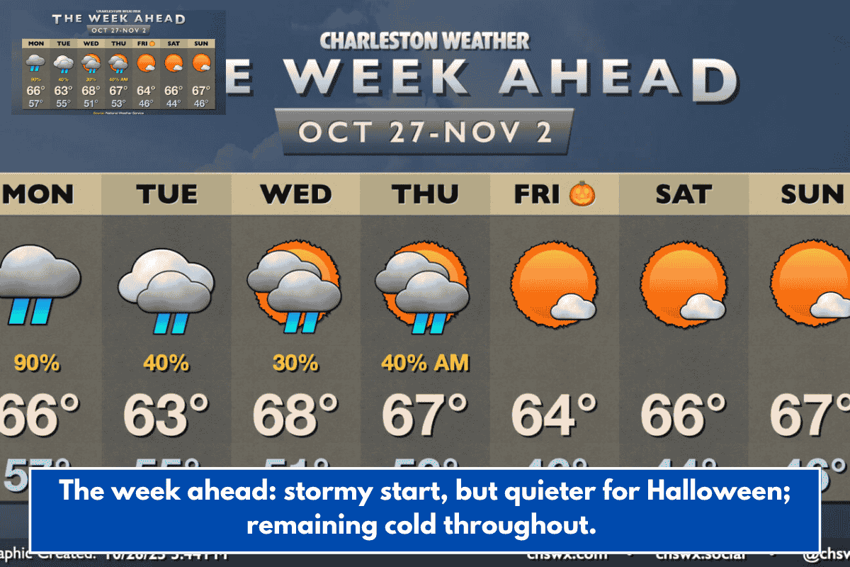
The last week of October will bring cooler-than-normal temperatures as well as spells of disturbed weather as a couple of storm systems pass through the area ahead of what should be a peaceful Halloween weekend.
After a week and a change of rain-free weather, rain resumes on Monday as a low pressure system forms and moves up the coast. The rain could become heavy at times, and we may hear thunder rumbles as some instability moves inland. Severe weather is not predicted, however. With the rain and cloud cover, temperatures will be substantially colder, with lows in the mid-50s rising only to the mid-60s in the afternoon.
Low pressure leaves overnight Monday and early Tuesday. With the leaving low, some lingering showers are possible, but the rain should not last all day. The sky will remain mostly gloomy, though some breaches in the cloud cover may occur later in the day as drier air attempts to force its way into the area. Northerly breezes will keep temperatures on the lower side of normal, with highs only reaching the low- to mid-60s in the afternoon.
Another storm system will reach the area on Wednesday and Thursday, increasing the likelihood of showers but also allowing for some cloud breaks. Lows will be slightly cooler, but highs will be slightly warmer, with temperatures in the upper 60s forecast Wednesday and Thursday. Conditions will improve as Thursday progresses, with the second storm system leaving. This will result in a much more settled and seasonable Halloween, with lows in the mid-50s rising to the mid-60s in the afternoon and largely sunny skies. November will begin to feel like, well, November, with lows in the mid-40s and highs in the mid-60s on Saturday and Sunday, plus plenty of sunshine.