Heavy rain and gusty winds are expected to cause havoc in the Carolinas this weekend as a Nor’easter forms off the coast.
Starting Friday, low pressure will form off the coast of South Carolina, bringing rain to the immediate shoreline.
The storm will continue to grow as it slowly creeps north over the weekend. Rain will persist along the South Carolina coast and into North Carolina on Saturday and Sunday before the cyclone moves north to New England.
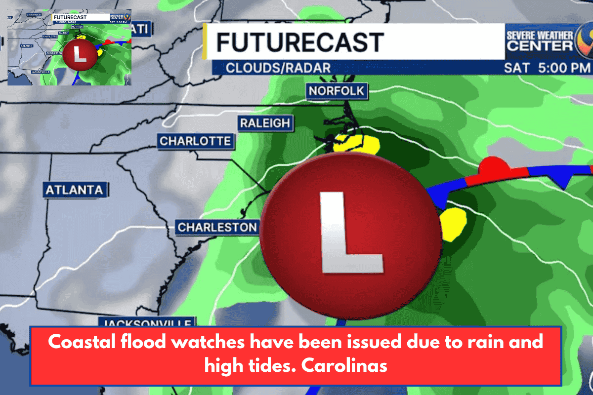
While the storm will not be tropical, it will bring heavy rains to the eastern Carolinas. Most areas might receive between one and four inches of rain. This rainfall is extremely alarming because it occurs during King Tides. Coastal Flood Watches are in effect for the Low Country of South Carolina, including regions in and around Charleston. A Coastal Flood Advisory is also in effect for eastern North Carolina’s Outer Banks and nearby areas.
Along with the concerns about heavy rain and flooding, very high gusts will also be an issue. This weekend, wind gusts will reach 30-40 mph throughout the coast, with gusts approaching 50 mph in the Outer Banks. As a result, coastal erosion will be a problem all weekend.
The forecast for the Charlotte metro area and into the mountains remains generally dry, with the area of low pressure offshore. However, the pressure gradient indicates that breezy conditions will persist for at least the first half of the weekend. These winds will be from the north, keeping humidity and temperatures near or below normal.