As a cold front moves through the Lowcountry overnight, residents can expect an increase in rain chances, thunderstorms, and a risk for localized flooding into the weekend. The weather will remain active, with heavy rainfall and stormy conditions continuing to impact the area.
Thunderstorms and Flooding Risk
Heavy thunderstorms will track southeastward across the region through 2 AM Saturday, with the greatest risk of severe weather east of I-95. The primary hazards include torrential rainfall, frequent lightning, and isolated strong wind gusts. These storms could lead to localized flooding in low-lying areas.
By daybreak Saturday, most of the storm activity will shift southward as the cold front moves into Georgia. However, isolated showers are still possible through the morning hours, with low temperatures expected to fall into the low to mid 70s.
Weekend Outlook: Scattered Rain and Cooler Temperatures
Scattered rain and thunderstorms will continue throughout the weekend. The risk of heavy rainfall will depend on how far south the cold front advances. The greatest chances for inclement weather will occur in the afternoons and evenings, when spotty downpours and localized flooding may affect certain areas.
Expect cooler-than-usual temperatures, with afternoon highs in the upper 70s and low 80s on Sunday and into early next week. Overnight lows will drop into the upper 60s to low 70s.
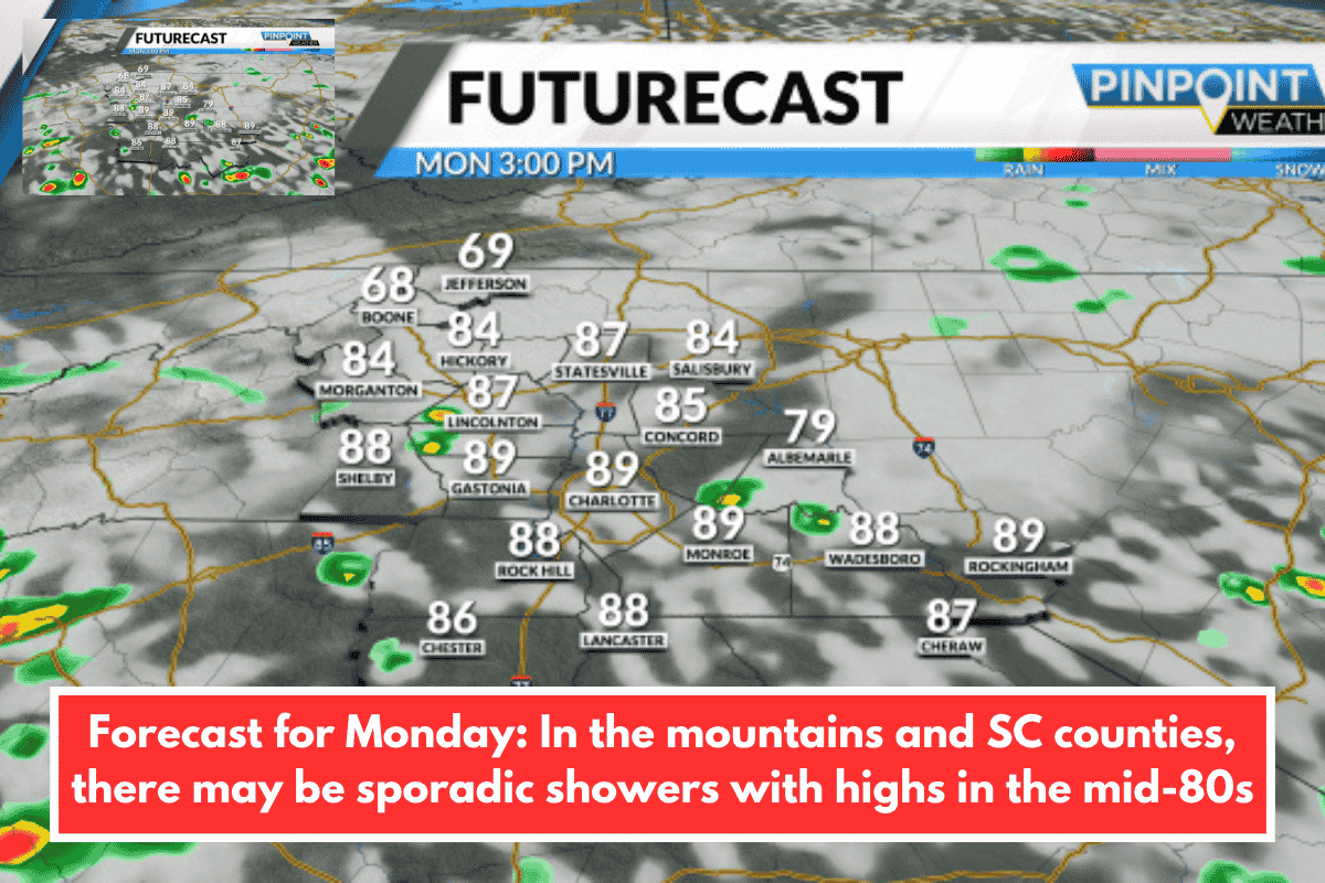
Detailed Forecast:
TONIGHT: Occasional downpours with light rain late. Low: 74°F.
SATURDAY: Partly sunny with scattered rain and storms. High: 85°F, Low: 72°F.
SUNDAY: Sun and clouds with scattered rain and storms. High: 83°F, Low: 73°F.
MONDAY: Sun and clouds with scattered rain and storms. High: 85°F, Low: 74°F.
Prepare for an active weekend with scattered rain and thunderstorms, particularly in the afternoons and evenings. While temperatures will be cooler, the threat of localized flooding and heavy rainfall remains a concern. Stay tuned to local forecasts for updates and be cautious if you’re out during heavy downpours.