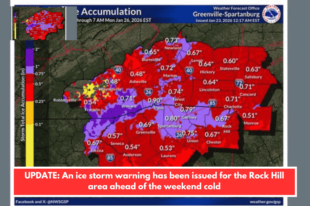
Rock Hill and surrounding York, Lancaster, and Chester counties in South Carolina face a major ice storm from Saturday afternoon through Monday, per National Weather Service warnings. Expect heavy sleet (up to 2 inches combined with snow in York/Chester), ice accumulations of 0.5–0.75 inches (higher in some spots), and minimal snow (1 inch or less in Rock Hill). This mix starts with sleet around 5 p.m. Saturday, shifting to freezing rain by 8 p.m., intensifying Sunday, and lingering into Monday morning.
Key Impacts and Risks
- Roads and Travel: Surfaces will turn “treacherous and impassable” due to ice; travel strongly discouraged. Monday commute could be crippled.
- Power Outages: Widespread and prolonged (days possible) from ice-weighted trees and lines.
- Temperatures: Saturday low ~20°F; Sunday high 32°F/low 20°F; Monday high 36°F/low 6°F. Lingering cold into next week raises hypothermia risks, especially with outages.
- Broader Context: Winter Storm Watch for both Carolinas; SC Governor Henry McMaster declared a State of Emergency to mobilize resources.
Preparation Tips
Stay safe by preparing now—conditions worsen rapidly Sunday.
- Stock non-perishables, water (1 gallon/person/day for 3+ days), battery-powered radio, flashlights, extra batteries, and backup heating (safely, like extra blankets).
- Assemble a vehicle kit: tire chains, shovel, booster cables, blankets, first-aid supplies, snacks, and water for potential stranding.
- Charge devices, have cash on hand, and identify a warming shelter via local alerts (check York County Emergency Management or SC Emergency Management Division sites).
- Protect pipes: drip faucets, insulate exposed areas.
- Monitor updates: NWS Columbia (for York/Chester) or Greer (Lancaster); apps like FEMA or local news for real-time changes.
Roads may stay icy into early next week, so plan for disruptions to power, schools, and services in your area.
Anything specific you’re prepping for, like home power backup or travel plans?