Columbus, Ga. – It’s been another scorching day in the region, with highs rising into the low to mid-90s. For the rest of the evening, a few pop-up showers are possible, but the heat is expected to remain a significant factor in the coming days.
Tropical Storm Chantal Update
Tropical Storm Chantal made landfall early Sunday morning near Charleston, South Carolina. As of this evening, Chantal has weakened to a tropical depression as it moves north. The storm has already caused heavy rainfall, with parts of North Carolina receiving up to 7 inches of rain. While Chantal weakens, the storm’s impact continues to affect surrounding areas.
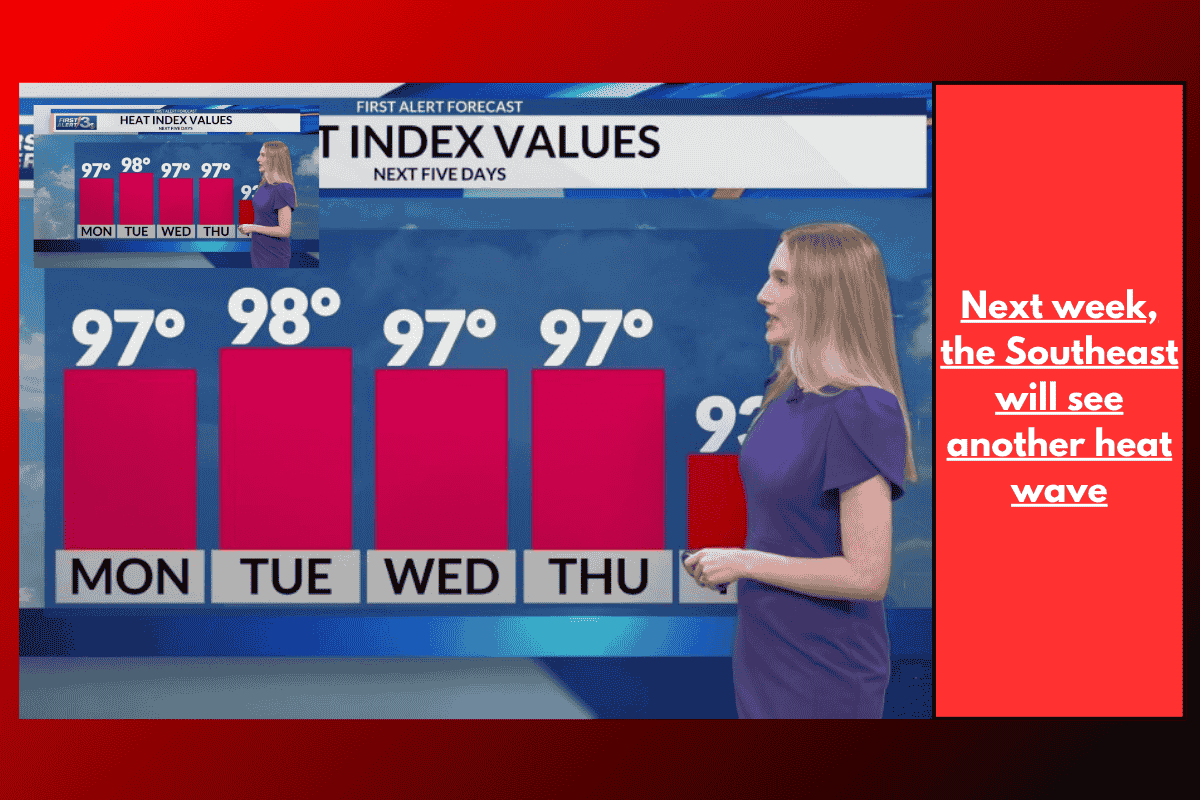
Heatwave Expected to Persist
As for local weather, temperatures will remain high, with readings climbing into the upper 90s at the start of next week. Excessive heat will cause the heat index to soar above 100 degrees from Tuesday through Friday, making it important for residents to take precautions against the extreme heat.
Rain Chances and Storms
Rain chances are expected to increase by Wednesday, with more widespread showers and storms likely toward the end of the week and into next weekend. There will be opportunities for storms throughout next weekend, offering some relief from the ongoing heat.