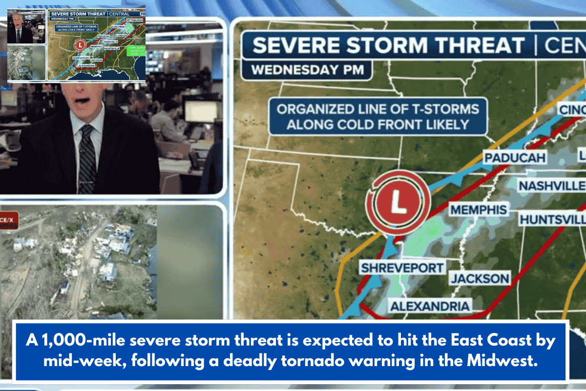
A multi-day severe weather threat spanning 1,000 miles is shifting from the Heartland toward the Eastern Seaboard through Thursday.
Current Threat Evolution
The cold front driving Tuesday’s storms will advance into the Mississippi, Ohio, and Tennessee Valleys, sparking thunderstorms despite some uncertainty from lingering overnight clouds and rain limiting instability.
Risk Areas and Hazards
Level 2/5 severe risk targets Nashville, Charleston (SC), and Pittsburgh, with potential for organized storms from low-level moisture and upper winds; isolated activity possible in the Deep South. Expect damaging winds, hail, and isolated tornadoes.
Precipitation Outlook
1-2 inches of rain forecast east of the Mississippi through Thursday, beneficial amid recent dry conditions—Thursday’s intensity hinges on Wednesday storm evolution, potentially weakening later risks if energy depletes early.