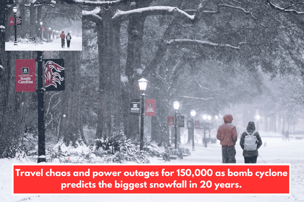
A bomb cyclone hit the Southeast U.S. over the weekend, bringing rare heavy snow, high winds, and power outages to parts of North and South Carolina, northern Georgia, and the Smoky Mountains. While the Carolinas dodged last week’s ice storm, this one dumped over 20 inches in some spots, tying records and causing widespread disruptions.
Snowfall Highlights
- Smoky Mountains/Faust, NC: Over 22.5 inches by Sunday morning.
- Charlotte, NC: 11 inches, heaviest in 20+ years (ties 4th snowiest day on record).
- I-85 corridor (Charlotte to Greensboro): 8-16 inches, among the storm’s heaviest.
- Eastern NC coast: 10 inches in Granby, 16 inches in Hammocks Beach.
- Longwood, NC (near Myrtle Beach/SC border): 17 inches.
- Charleston, SC: Less than 1 inch.
This marks unusually heavy snow for the region, where plows and de-icers are limited.
Impacts and Disruptions
- Power outages: Over 150,000 customers affected.
- Travel chaos: Hundreds of flight cancellations (e.g., 388 at Charlotte Douglas, 55 at Raleigh-Durham, 20+ at Myrtle Beach and Charleston). Interstates 26, 40, 64, 75, 77, 81, 85, and 95 remain hazardous with ice.
- Cold snap: Sub-freezing temps through Sunday, dropping to teens or single digits at night. Wind gusts make it feel brutally colder.
- Coastal risks: High winds creating large waves and moderate flooding from NC to Delmarva.
- Lingering effects: Icy roads all week due to nightly freezes; snow removal ongoing in mid-SC to NC.
NC DOT urged residents to stay home amid the mess.
Forecast and Safety Tips
Temps may hit high 30s/low 40s Sunday daytime in Charlotte/northern SC, but expect quick drops. For your area in South Carolina (near the Lowcountry), lighter snow means focus on wind chills and potential coastal flooding—check SCDOT for road updates and local alerts like those from FOX Carolina or WCBD.
Stay safe: Avoid travel if possible, layer up for wind chill, and monitor power restoration via Duke Energy or utilities. What’s the snow like where you are right now?