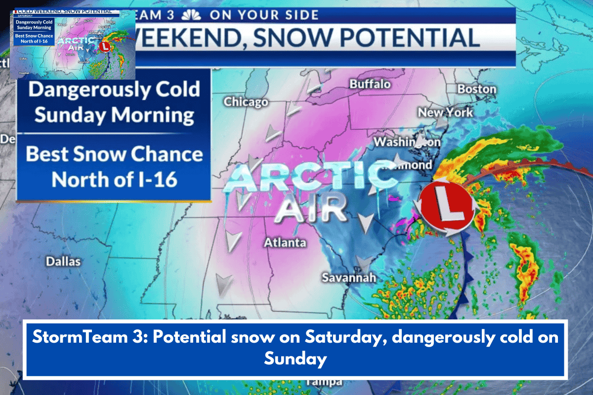
This forecast from StormTeam 3 outlines quiet, chilly conditions mid-week transitioning to a cold weekend with potential light snow. Here’s a clear breakdown:
Thursday (Today)
- Quiet start with increasing clouds in the afternoon.
- Highs: Upper 40s to lower 50s—stay bundled up.
Friday
- Dry and mild improvement.
- Highs: Upper 50s to lower 60s—perfect for outdoor plans before the chill returns.
Weekend Outlook
A low-pressure system moves through Friday night into Saturday, bringing cold rain initially, then possible snow as arctic air surges in.
| Day/Time | Conditions | Temps | Precip Chance | Notes |
|---|---|---|---|---|
| Sat Morning/Lunch | Cold rain, possible rain-snow mix | Mid-30s by lunch; upper 30s-lower 40s overnight | 40% POP | Temps drop below freezing afternoon onward. |
| Sat Afternoon/Evening | Snow showers or flurries (not constant) | 30s (wind chills in 20s) | 40% POP | Best accumulation chance north of I-16 (Lowcountry); lighter south of it (e.g., Alma, Baxley). Accumulations depend on storm track. |
| Sun Morning | Bitter cold | Teens (wind chills single digits) | Low | Dangerous cold—protect pipes, pets, and people. |
Next Week
Milder air builds back in gradually, with highs reaching mid-to-upper 50s by Wednesday.
Key Advice: With arctic air and potential wintry mix, prepare for slippery roads Saturday if snow hits your area (especially north of I-16). Layer up, check on vulnerable folks, and monitor updates as the storm’s path refines totals. Safe travels!
Living near South Carolina’s Lowcountry, this could spill over—want a customized forecast for there or tips on prepping for cold snaps?