CHARLESTON, S.C. – The weak front responsible for Saturday’s scattered downpours has pushed to the south, bringing a brief break in the rain for today. However, isolated thunderstorms are still possible this afternoon, with any storms producing heavy rainfall, localized flooding, and frequent lightning.
Afternoon highs today will be in the upper 80s and low 90s, with heat index values ranging between 100-105°F. The decrease in rain coverage will allow temperatures to rise slightly on Monday.
The upcoming week looks to remain mostly dry, but trends will continue to be monitored due to the distant Hurricane Erin and an approaching cold front by midweek.
Week Ahead Forecast
Today: A few clouds with isolated afternoon storms. High of 91, Low of 74.
Monday: Mostly sunny in the morning, becoming cloudy in the afternoon. High of 94, Low of 75.
Tuesday: Partly cloudy and mainly dry. High of 91, Low of 75.
Wednesday: Partly cloudy with a small chance of rain. High of 92, Low of 76.
Tropical Update: Hurricane Erin
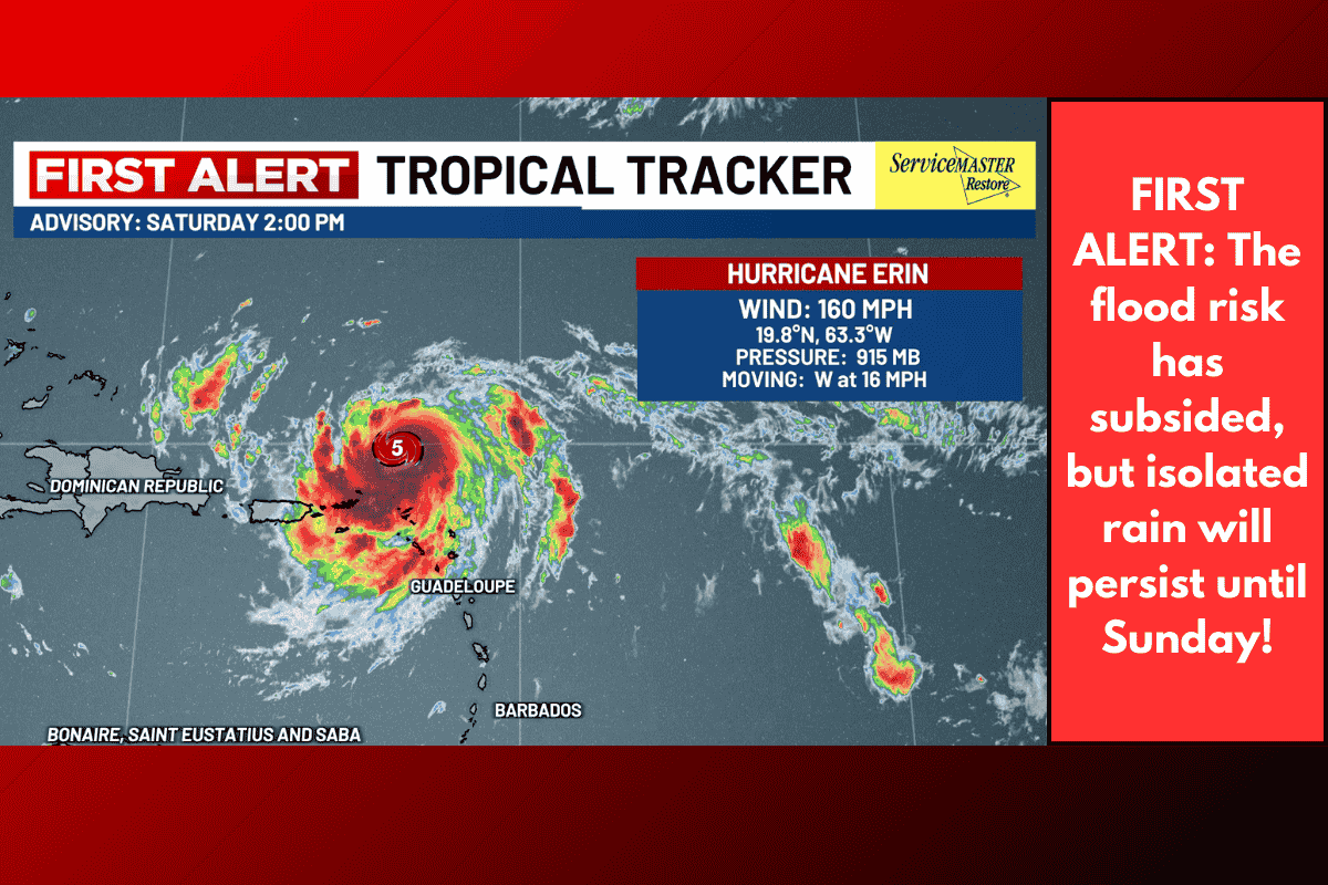
Hurricane Erin intensified rapidly, reaching Category 5 status on Saturday. Although Erin will weaken in the coming days due to eyewall replacement cycles, it is expected to remain a major hurricane (Category 3 or greater) through midweek.
Erin is forecast to pass safely hundreds of miles east of the Lowcountry coastline by midweek, but even with this offshore track, dangerous swells will heighten the concern for rip currents and high surf starting Monday. Minor coastal flooding is also possible during evening high tides, beginning Monday.
Make sure to keep the Live 5 Weather app handy for the latest updates on local conditions!