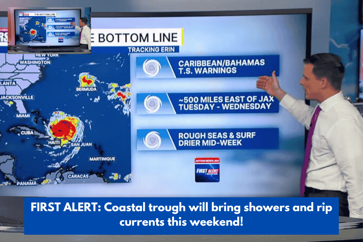
Charleston, South Carolina – All eyes are on a coastal disturbance to our south, which is expected to deliver us more rain this weekend and early next week!
Clouds are forecast to gradually develop tonight as our coastal trough approaches the Lowcountry. Brief, localised rains cannot be ruled out along the coast beginning before dawn Saturday. Morning lows should fall into the upper 50s and 60s, slightly warmer than prior nights.
Although a few showers are expected on Saturday, the likelihood of rain increases on Sunday. The concentration for locally severe rainfall has shifted south of the Lowcountry until early next week; nevertheless, a quick deluge or rumbling of thunder cannot be discounted.
Winds will remain brisk until early next week due to the gradient between the aforementioned disturbance to our south and a strong region of high pressure to our north. Expect wind gusts of 25-30 MPH on occasion, particularly along the shore.
Our current pattern continues to favour a significant rip current risk and an extended period of higher high tides. Minor coastal flooding is anticipated between Saturday and Sunday evening high tides (about 7 p.m. each day). The probability of significant coastal flooding, possibly to moderate or major flood stage, may rise next week due to a combination of favourable winds and an approaching Full Moon phase.
TROPICS: The National Hurricane Centre is tracking two Atlantic basin disturbances: a developing coastal trough in the Southeast coast and a tropical wave in the Eastern Atlantic. Forecast models predict gradual development of the latter system as it approaches westward, possibly near to the Lesser Antilles, over the following week. We will continue to watch trends!
Tonight: Patchy clouds. A stray coastal shower arrives late. The lows are in the 60s.
SATURDAY: Mostly cloudy and breezy. Stray Shower Is Possible. High 82, Low 70.
SUNDAY: Mostly cloudy and breezy. Showers are scattered. High 81, Low 68.
MONDAY: Mostly cloudy and breezy. Isolated rain/storms. High 81, Low 69.