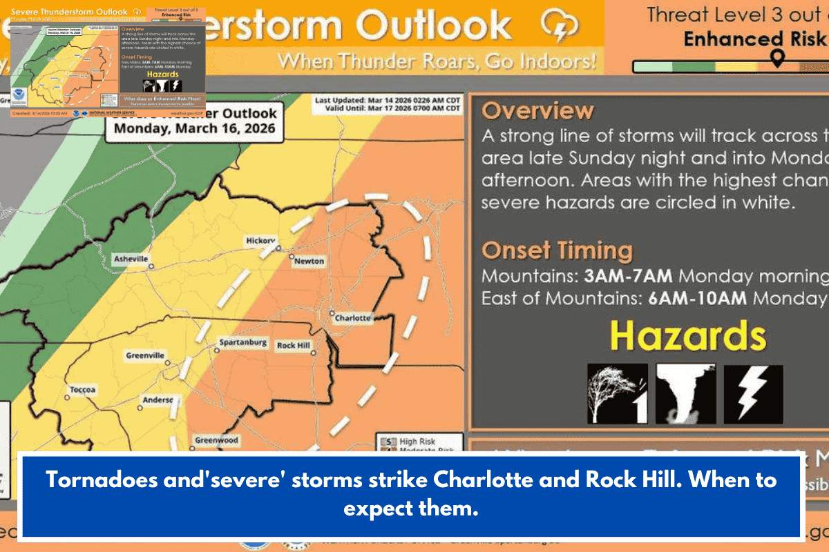
Charlotte, Rock Hill, and Hickory face the highest risk of severe thunderstorms, tornadoes, damaging winds, and large hail in the Western Carolinas on Monday, March 16, 2026, between 6-10 a.m. ET. The National Weather Service (NWS) Greer office rates this as an “enhanced risk,” with highest confidence east of the mountains, along/east of I-77 and south of I-85.
Timeline and Threats
- Sunday evening: Possible isolated storms, but low concern.
- Monday morning: Main line of thunderstorms hits early (possibly before dawn in far west Upstate SC), peaking 6-10 a.m. in Charlotte area; continues through midday statewide.
- Primary dangers:
- Tornadoes (higher odds near Charlotte).
- Damaging straight-line winds (can snap trees, down power lines, damage homes/cars).
- Large hail.
- Recent context: 5 tornadoes hit eastern NC Thursday, causing injuries and damage.
Schools, buses, and commuters will be active—plan safe spots now (avoid mobile homes).
Charlotte Forecast Snapshot
| Day | High Temp | Precip Chance | Notes |
|---|---|---|---|
| Sat (Mar 14) | 73°F | Low | Mostly clear |
| Sun (Mar 15) | 72°F | 80% late | Showers into Monday |
| Mon (Mar 16) | 69°F | 90% daytime | Severe storms peak |
| Tue (Mar 17) | 45°F | Low | Sunny, cooler |
| Wed (Mar 18) | 50°F | Low | Clearing up |
Safety Tips
- Identify your safe place (interior room, away from windows).
- Sign up for wireless alerts (e.g., NWS app, local emergency notifications).
- Avoid travel if possible during peak; secure outdoor items.
- Track updates: NWS Greer or Charlotte Observer.
Stay safe—severe weather like this can shift fast. Got plans in the area Monday?