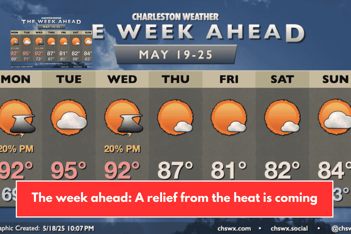
The week begins with more of the warm temperatures we’ve been having lately. On Monday, it will start around 70°F and climb to the low 90s in the afternoon. The sky will have fewer clouds. There might be a storm or two late in the day when the seabreeze moves inland. Some storms could also come from the north, but most areas will likely stay dry. Still, it’s good to be prepared for a stray shower.
Heat Peaks on Tuesday
Tuesday will be the hottest day, with temperatures reaching the mid-90s and partly cloudy skies. The chance of thunderstorms is very low, but you can’t completely rule them out.
Chance of Showers and Thunderstorms on Wednesday
On Wednesday, a weather system will come closer, bringing a chance of showers and thunderstorms in the afternoon. Right now, models suggest it won’t be very wet, but this may change as the day gets nearer.
Cold Front Brings Cooler Weather Late Week
The cold front will pass through Wednesday night and move away by Thursday. After this, westerly winds will keep Thursday warm with highs near the upper 80s. From Friday, winds shift more to the north, bringing cooler temperatures with lows in the upper 50s to low 60s and highs around the low 80s.
Pleasant and Sunny Memorial Day Weekend
By Memorial Day Weekend, the weather will feel more like spring. It will be sunny, mild, and comfortable for outdoor activities.
This week starts hot but ends with cooler, more comfortable weather thanks to a cold front. Early in the week, temperatures reach the 90s with only a small chance of storms. By late week and into the holiday weekend, expect plenty of sunshine and milder temperatures in the 80s, making it a perfect time to enjoy outdoor plans. Keep an eye on the forecast for any changes, especially midweek when showers might occur.