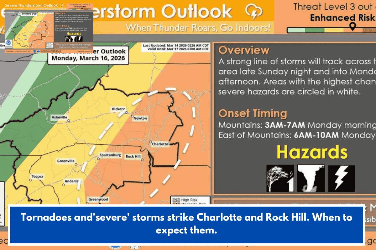
Eastern Georgia and central South Carolina face Level 2-3 severe thunderstorm risks (per NOAA Storm Prediction Center) on Monday, March 16, 2026, with damaging winds (60-65 mph) as the top threat, plus tornado potential along the I-20 corridor.
Peak Timing and Areas
Impacts hit mid-afternoon through evening commute, affecting Atlanta, Augusta, Savannah (GA), Columbia, Greenville (SC), and routes like I-20, I-26, I-95. Storms move from GA into SC, then north to NC/Mid-Atlantic overnight.
Main Hazards
- Widespread wind gusts: Tree/power line damage, travel disruptions.
- Tornadoes: Several possible in rotating storms; brief spin-ups with short warning.
- Other: Hail, quick onset.
Prep Steps
Secure outdoor items, charge devices, know tornado plans (interior low spot). Monitor NOAA/NWS for watches/warnings. Ties into ongoing SE severe pattern this month. Safe travels if commuting!