Keeping roads safe and smooth is a big task, and Charleston County is stepping up to do just that. They’ve just launched a detailed road check-up to figure out which roads need fixing first. With over 4,300 lane miles to look at, the county is using smart technology to make sure they’re spending money wisely and fixing the roads that need it most.
What Is the Road Assessment About?
Charleston County is checking the condition of thousands of lane miles across the area. This includes roads the county looks after, roads managed by nearby towns, and smaller state-paved roads. However, big highways and interstates are not part of this survey.
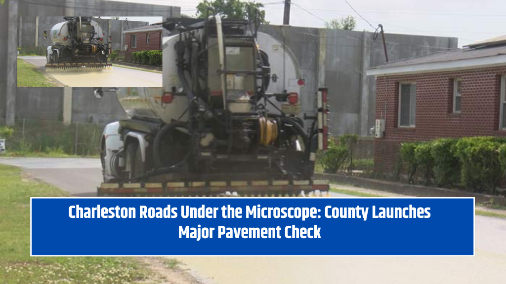
To carry out this project, the county is working with a local engineering company called Michael Baker International. They’re using a special van loaded with top-tier technology—like lasers, high-definition cameras, and smart navigation tools. This vehicle will scan the roads for cracks, potholes, and ruts, helping experts see which roads are in the worst shape.
How Will the Data Be Used?
The main goal is to use real data to make smart choices about which roads to resurface. Charleston County’s Public Works Engineering Manager, Mackenzie Kelley, explains that the data will help decide which roads are in the worst condition and need fixing first.
Every four years, the county updates its road condition database. This update is crucial because it guides their long-term plan for resurfacing and maintaining roads. With fresh, accurate information, they can make sure money is spent on the right projects.
A Smarter, Fairer Way to Fix Roads
In the past, road repair decisions were often based on complaints. Whoever made the most noise got their road fixed first. But now, the county uses real data. This means roadwork is planned based on actual damage and how many cars use each road daily.
Alex Owsiak, the county’s Public Works Transportation Program Manager, said it clearly: they want to get the best value for their money. Roads that are both busy and damaged will get top priority. That way, they fix the roads more people use and that need the most help.
Funded by Local Tax and Completed in Two Months
This assessment will cost $231,140 and is being paid for through the county’s transportation sales tax. The work has already started and should take about two months to finish. Once it’s done, the county will have a clear roadmap for which streets need to be resurfaced first.
Charleston County’s use of technology to assess road conditions is a smart move. It replaces guesswork with solid facts, saving time and money. This data-driven method also ensures that busy roads get attention first, helping the whole community. The project shows how combining technology with planning can make roads safer and more efficient for everyone.