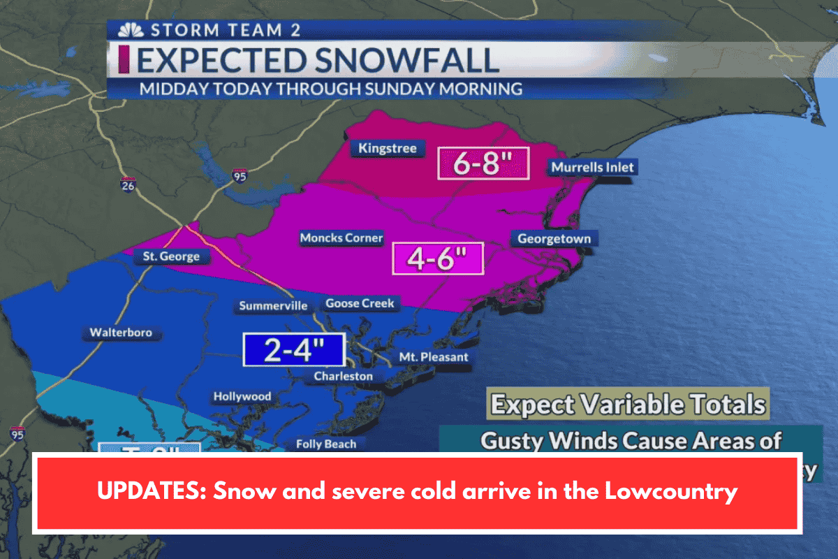
Snow continued falling in the Charleston Lowcountry from Saturday afternoon through early Sunday morning, February 1, 2026, as part of Winter Storm Gianna, exacerbating icy road conditions.
Precipitation Details
Initial light rain shifted to snow around 1-3 p.m. Saturday, with heavier accumulations overnight totaling 0.60 inches at Charleston International Airport, 0.75 inches in North Charleston, and up to 1.30 inches in areas like Cane Bay. Forecasts predicted 1-5 inches regionally, rarer for coastal South Carolina, under Winter Storm Warnings until 1 p.m. Sunday.
Road Impacts
Hazardous travel persisted into early morning due to ice on bridges and overpasses, prompting closures like Stono River Bridge and SCDOT treatments; officials advised staying home. An Extreme Cold Warning accompanied wind chills in the single digits.