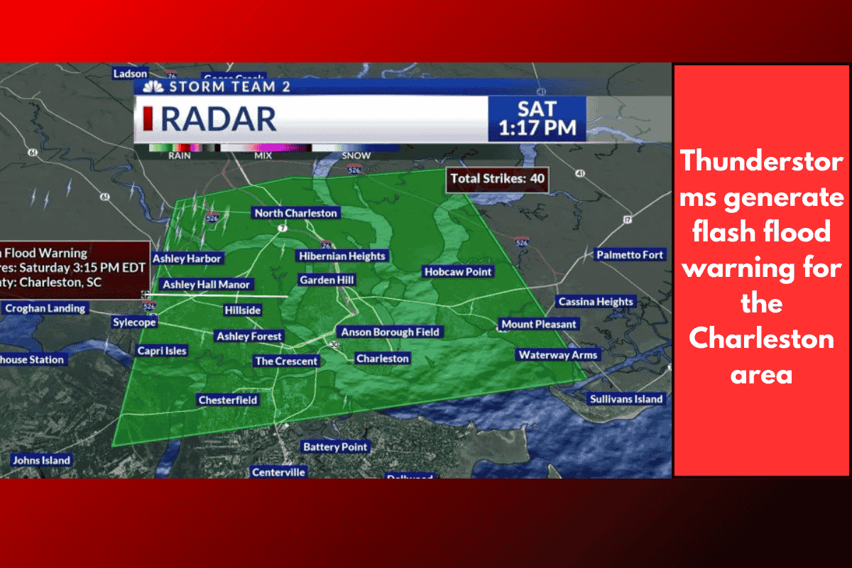
Thunderstorms Cause Flooding in Multiple Areas
CHARLESTON, S.C. – A flash flood warning has been issued for the Charleston Metro area on Saturday afternoon due to thunderstorms moving through the region. The warning will remain in effect until 3:15 p.m. and includes portions of West Ashley, North Charleston, Daniel Island, Mount Pleasant, and James Island.
Rainfall and Flooding Details
According to the National Weather Service, Doppler radar has indicated thunderstorms producing heavy rainfall across the warned area. Between 1 and 2 inches of rain have already fallen, and an additional 1 to 2 inches is expected, which may lead to further flooding.
Road Closures in Downtown Charleston
Several roads in downtown Charleston are currently closed due to flooding:
Calhoun Street – Pitt to Ashley Ave.
Charlotte Street at Concord
Cool Blow at Nassau
E Bay Street between Amherst and Chapel
Fishburne Avenue and Hagood Avenue
Huger Street between Benson and Dingle
King Street at Huger Street
Morris Street between Jasper and Coming
Nassau Street at Cool Blow Street
Ogier Street
Rutledge Avenue at Simon Street
Spring Street at Hagood
Washington Street at Society Street
Drivers are advised to avoid these areas and exercise caution as conditions may change rapidly.