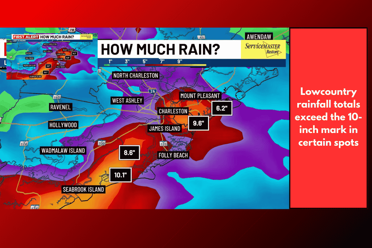
Charleston and surrounding Lowcountry communities are dealing with dangerous flooding conditions after relentless rainfall since Friday. By Saturday morning, some coastal areas had already reported 8 to 10 inches of rain in just 24 hours—more than what the region typically sees in an entire month.
Heavy Rainfall and Inland Flooding
According to Live 5 First Alert Meteorologist Chris Holtzman, the nonstop downpours have left streams rising and low-lying areas swamped with standing water. A flood warning is in effect for Charleston County until midnight Saturday, as runoff from earlier rainfall continues to overflow streams and drainage systems.
Motorists should expect slow-moving water and impassible streets throughout the day. Authorities are urging drivers to avoid flooded roads and never attempt to cross standing water.
Coastal Flooding Risk at High Tide
In addition to inland flooding, a coastal flood warning has been issued for Charleston and coastal Colleton counties from 6 p.m. Saturday through midnight.
High tide is forecast for 9:04 p.m., and forecasters warn that saltwater inundation will be possible 1–2 hours before and after high tide.
Communities along the shoreline and tidal waterways may experience 1–2 feet of flooding above ground level, making several roads impassible and disrupting travel across the coastal region.
What Residents Should Expect
Flooded roads and standing water throughout Charleston County
Saltwater flooding near high tide, especially in coastal Colleton and Charleston counties
Road closures and travel delays, particularly Saturday evening
Rising streams and waterways continuing into late night hours
Local officials encourage residents to allow extra travel time, move vehicles to higher ground, and monitor local alerts for the latest updates.