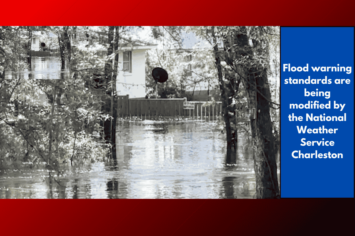
The National Weather Service in Charleston is making important changes to the criteria for issuing flash flood warnings in the Lowcountry. These updates aim to improve the effectiveness of warnings and ensure the community is better prepared for extreme weather events.
What Is a Flash Flood Warning?
A flash flood warning is issued when an area that has already experienced significant rainfall is unable to handle additional rainfall within a short period. It’s more serious than a flood advisory and signifies that conditions could lead to dangerous flooding. The TriCounty area often experiences flood advisories, but a flash flood warning indicates an immediate threat to safety.
According to Rob Fowler, the Chief Meteorologist from Storm Team 2, flash flooding can be deadly. “Flash flooding is one of our unfortunately biggest killers because moving water is very powerful. We know that living next to the ocean, it can move cars off the road, it can knock people down,” Fowler explained.
New Criteria for Flash Flood Warnings
The National Weather Service Charleston is updating the criteria for issuing flash flood warnings to make them more impact-focused. Some of the new criteria include:
Multiple roads or intersections that are flooded and closed to traffic.
Vehicles stranded or stalled in floodwaters.
Structures surrounded by floodwaters.
A river gauge exceeding its minor flood stage at a location not previously forecasted.
The occurrence or risk of a dam or levee failure.
These changes will help ensure that warnings are issued based on the actual impact of flooding, not just on rainfall totals alone.
Maintaining Safety and Preparedness
Even with the new criteria, Storm Team 2 assures viewers that they will continue to provide plenty of warnings and updates ahead of flash flood events. The aim is to align the warnings with the latest forecasting methods while ensuring that safety information remains clear and timely.
Community Response and Coordination
On Tuesday, emergency departments in the TriCounty area will meet to discuss how to respond to these updated flash flood warnings. This coordination is crucial for ensuring that local agencies and responders are well-prepared to handle the impact of flooding.
The changes to flash flood warning criteria are intended to help residents of the Lowcountry stay better informed and safe during extreme weather events. As the National Weather Service Charleston continues to adapt to evolving forecasting technology, it’s important for the community to stay alert and be prepared for flash floods.