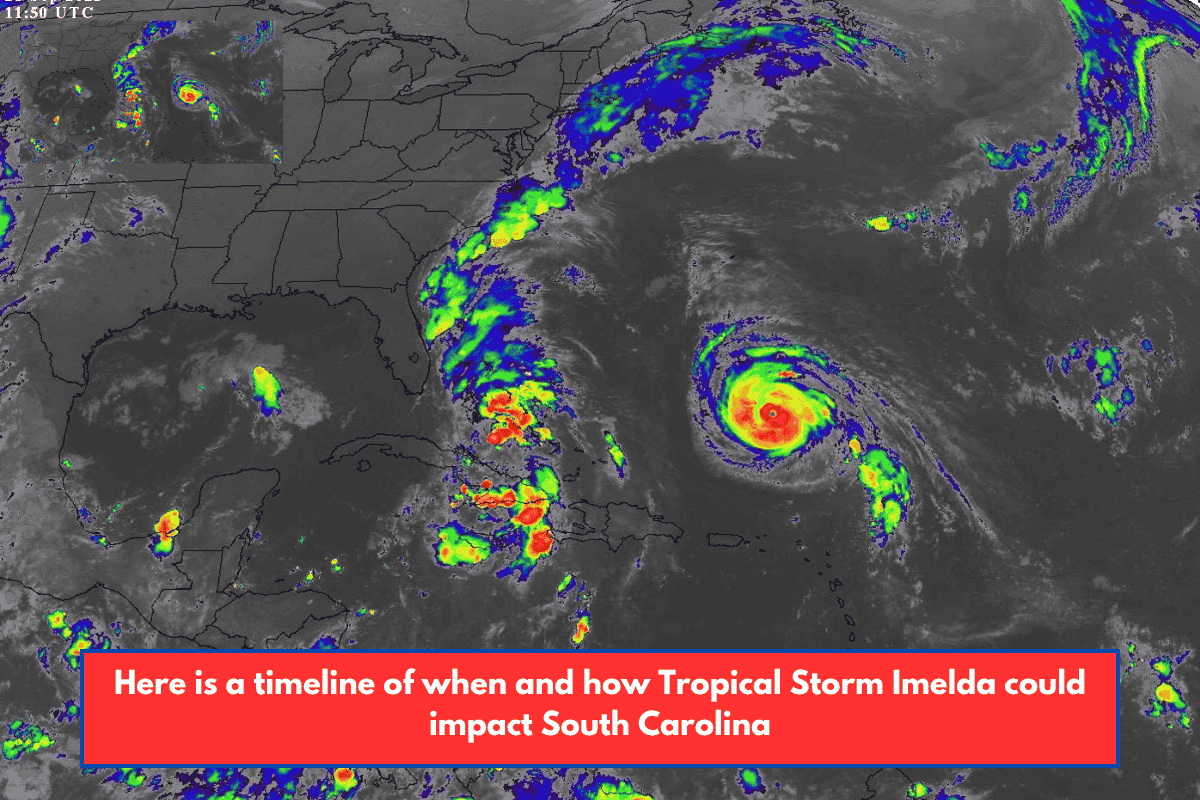
Although the National Weather Service (NWS) believes that Tropical Storm Imelda will continue in the Atlantic and steer clear of the United States’ East Coast, South Carolina may experience storm-related consequences this week.
According to NWS meteorologist Matt Scalora, South Carolina will have intermittent rains on Monday and Tuesday. Heavy rain is forecast along the coast, particularly on the north side of the South Carolina coastline, where localities may receive up to 2 inches of rain.
“We’re looking at up to 1 to 2 inches of rain, and that would be mainly through tomorrow, and then we definitely dry out by Wednesday through the end of the week,” according to Scalora.
Flooding threats are reduced with lower rainfall estimates, although they remain probable until Tuesday.
“There could be localized flash floods, but it should be really isolated, because the rain amounts have definitely come down, and that would be again, today or tomorrow, and the same deal with the winds, for the most part,” according to Scalora.
Coastal flooding is probable through the middle to late week, particularly in low-lying and prone locations, as well as during afternoon high tides. According to Scalora, surf heights of 4 to 6 feet on the south coast and 5 to 6 feet on the north shore should remain till midweek.
While land impacts are likely to be minor, the surf will be dangerous this week. The combination of hazardous waves from Tropical Storm Imelda and Hurricane Humberto is causing severe surf, rip currents, and the possibility of waterspouts on Monday and Tuesday. Both coastal South Carolina NWS offices have issued high-surf advisories.