A stubborn stationary front hovering just south of the Lowcountry brought multiple rounds of heavy rain and flash flooding to the Charleston area on Friday, prompting officials to issue a First Alert Weather Day that remains in effect through Friday night. With saturated ground and more rain on the way, flooding concerns are likely to continue or worsen in many areas.
Flash Flooding Hits Low-Lying Areas
Friday’s rainfall hit hard and fast in parts of Charleston, North Charleston, Summerville, and Johns Island, leaving roads underwater, vehicles stranded, and traffic backed up. Several neighborhoods experienced street-level flooding, with local emergency crews responding to multiple calls for assistance.
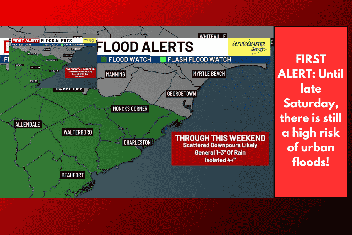
Flood Watch Continues for Most of the Lowcountry
The Flood Watch remains active for most of the Lowcountry through Friday night, excluding only Williamsburg and Georgetown Counties. Forecasters warn of the risk of more scattered downpours, with most areas expected to see an additional 1 to 3 inches of rainfall. However, isolated totals of over 4 inches could fall in spots that get hit by multiple rounds of rain.
Relief Coming Soon
There’s good news on the horizon. A stronger cold front is expected to move into the Carolinas later this weekend. While Sunday may bring a few fast-moving storms, a drier and sunnier pattern is expected to settle in by Tuesday.
Temperatures will begin to rise into the upper 80s and low 90s early next week, but the approaching front should bring below-average temperatures and drier air by mid-to-late week.
Lowcountry Weather Forecast at a Glance
TODAY (First Alert Weather Day):
Scattered rain, heavy at times.
High: 79° | Low: 72°
SUNDAY:
Mix of sun and clouds, isolated showers or storms.
High: 86° | Low: 73°
MONDAY:
Partly cloudy with isolated rain/storms.
High: 91° | Low: 70°
TUESDAY:
Mostly sunny and drier.
High: 88° | Low: 69°
WEDNESDAY:
Mostly sunny and pleasant.
High: 86° | Low: 68°
The Lowcountry is experiencing yet another round of flooding as heavy rain from a stationary front continues to impact the region. Residents are urged to remain cautious and avoid flooded roads. With more rain expected overnight, the risk of flash flooding will persist into Saturday morning. Thankfully, a break is on the way starting Sunday and into next week, bringing not just drier skies but also more comfortable temperatures by midweek. Keep an eye on weather updates and stay safe.